GS-960 LiDAR Scanning System Long Range 750m AGL Geographic Mapping
Geosun gAirHawk Series 960 LiDAR Scanning System
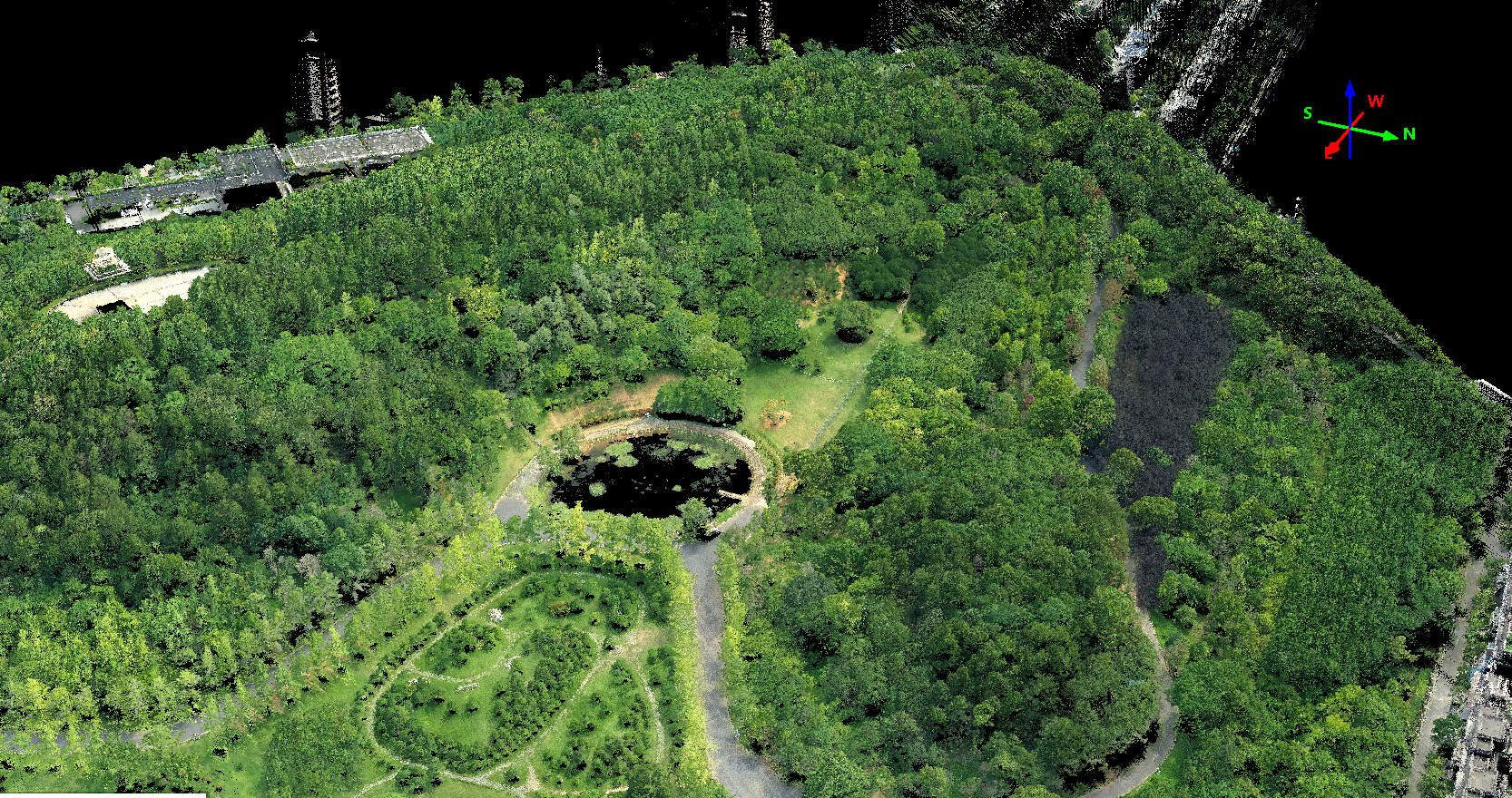
gAirHawk GS-960 is a kind of long range, compact LiDAR point cloud data acquisition system, integrated Riegl laser scanner, GNSS and IMU positioning and attitude determination system, and storage control unit, is able to real-time, dynamically, massively collect high-precision point cloud data and rich image information. It is widely used in the acquisition of 3D spatial information in surveying, electricity, forestry, agriculture, land planning.
Specification of LiDAR Scanning System
| LiDAR Scanning System gAirHawk GS-960 |
| | Item Name | System Parameters |
|
GS-920
Parameters | Weight | 1.6kg (45MP Camera) |
| Working temperature | -10℃~+40℃ |
| Power range | 24V |
| Consumption | 70 W |
| Carrying Platform | DJI M300/M350/Multi-Rotor/VTOL |
| Storage | 256GB |
| Lidar Unit | Measuring Range | 500m@20% Reflectivity; 1000m@80% Reflectivity |
| Laser class | 1535nm Class1 (IEC 60825-1:2014) |
| Scan Rate | 300 lines per second |
| Measuring accuracy | 5mm |
| Max. Range | 750m |
| Return | Unlimited |
| Point Frequency | 100KHZ~550KHZ |
| FOV | 80° |
| POS Unit | Update frequency | 200HZ |
| Heading accuracy | 0.017° |
| Pitch accuracy | 0.005° |
| Rolling accuracy | 0.005° |
| Position accuracy | Horizontal: 0.02m, Vertical: 0.03m |
| GNSS signal type | GPSL1/L2/L5 GLONASSL1/L2 BDS B1/B2/B3 GAL E1/E5a/5b |
| Model | gSpin 310 |
| Pre-processing software | POS software | Output information: position, speed, attitude |
| Point cloud software | Output point cloud data format: LAS format, custom TXT format |
| Camera (option) | Effective Pixel | 45 Mega Pixel |
| Trigger event | Distance or Time trigger |
| FOV | 79° |
Application of LiDAR Scanning System gAirHawk GS-960
Package of LiDAR Scanning System gAirHawk GS-960
LiDAR Scanning System gAirHawk GS-960 is packed by suit case with EVA material liner inside, then covered by hard carton box. It is suitable for air shipment and sea shipment.

Product Tags:

|
|
Geosun gAirHawk Series GS-960 LiDAR Scanning System Long Rang Geographic Mapping Images
|


